![](/images/other/stat-length.png)
![Trail Walking Le Monêtier-les-Bains - Col des Grangettes par le pas de l'ane - Photo](https://media.geolcdn.com/t/1900/400/ext.pjpeg?maxdim=2&url=https%3A%2F%2Fservices.sitytrail.com%2FGeolivesWS%2FDownloadMedia.ashx%3FTrailID%3D465128%26Media%3Dfix__20150828123618.jpg)
Col des Grangettes par le pas de l'ane
amiral13
User GUIDE
![Length](/images/other/stat-length.png)
![Max alt](https://static1.geolcdn.com/siteimages/upload/files/1508320355ic_sort_altitude_max_24dp.png)
![Uphill gradient](https://static1.geolcdn.com/siteimages/upload/files/1508320355ic_sort_den_pos_24dp.png)
![Km-Effort](/images/other/stat-length.png)
![Min alt](https://static1.geolcdn.com/siteimages/upload/files/1508320355ic_sort_altitude_min_24dp.png)
![Downhill gradient](https://static1.geolcdn.com/siteimages/upload/files/1508320355ic_sort_den_neg_24dp.png)
![Boucle](https://static1.geolcdn.com/siteimages/upload/files/16400158638029165_repeat_loop_refresh_sync_direction_icon.png)
![Walking](https://static1.geolcdn.com/sitytour/trail-icons/101.png)
4h16
Difficulty : Very difficult
![Scan this QR Code to open this trail in the SityTrail application](https://capi.geolives.com/qq0zvz2zws4bq2lad0pu/sitytour/trails/465128/qr.png?size=200)
FREE GPS app for hiking
About
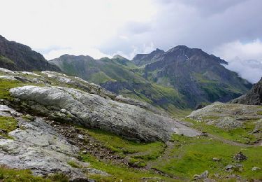
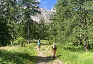
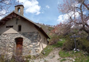
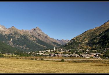
Trail Walking of 7.4 km to be discovered at Provence-Alpes-Côte d'Azur, Hautes-Alpes, Le Monêtier-les-Bains. This trail is proposed by amiral13.
Description
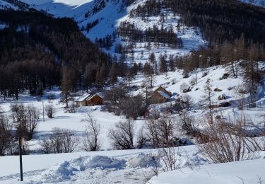
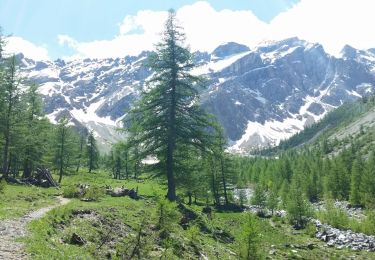
Attention, la montée au col des Grangettes est un itinéraires de hautes montagnes à réserver aux personnes en ayant l'expérience. à éviter par mauvais temps et brouillard; les deniers 100 m de dénivelée demande recherche d'itinéraire (balisage peu visible) et utilisation des mains pour quelques passages d'escalade.
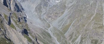
d'autre part, cette montée est exposée aux chutes de pierres, tout comme la sente depuis le vallon de la montagnolle.
Au départ du télésiège ne pas hésiter à redescendre sous le télésiège de l'yret ce qui vous évitera une mauvaise piste.
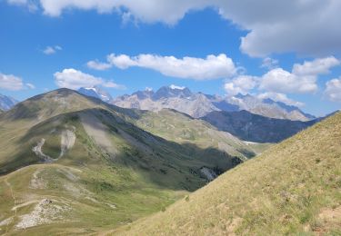
au pas de l’Âne une jolie vue sur le sommet des Agneaux vous accueillera.
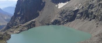
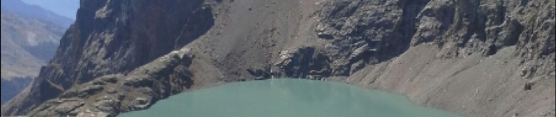
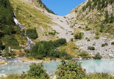
Du col des Grangettes magnifique vue plongeante sur le lac De l'Eychauda
Positioning
Comments
Trails nearby
![Trail Walking Saint-Chaffrey - le Prorel au départ de la Serre Chevalier - Photo](https://media.geolcdn.com/t/375/260/8fe43045-679c-4525-8bd4-b81d7f3d7490.jpg&format=jpg&maxdim=2)
![Walking Walking](https://static1.geolcdn.com/sitytour/trail-icons/101.png)
Walking
![](/images/other/stat-length.png)
![](https://static1.geolcdn.com/siteimages/upload/files/16400158638029165_repeat_loop_refresh_sync_direction_icon.png)
![Trail Walking Vallouise-Pelvoux - Lac Eychauda - Photo](https://media.geolcdn.com/t/375/260/ext.jpg?maxdim=2&url=https%3A%2F%2Fservices.sitytrail.com%2FGeolivesWS%2FDownloadMedia.ashx%3FTrailID%3D329974%26Media%3D669f5c07-e99c-447f-ad93-3bbc64c384fe.jpg)
![Walking Walking](https://static1.geolcdn.com/sitytour/trail-icons/101.png)
Walking
![](/images/other/stat-length.png)
![](https://static1.geolcdn.com/siteimages/upload/files/16400158638029165_repeat_loop_refresh_sync_direction_icon.png)
![Trail Walking Le Monêtier-les-Bains - Lac du Glacier d'Arsine - Photo](https://media.geolcdn.com/t/375/260/ext.jpg?maxdim=2&url=https%3A%2F%2Fstatic1.geolcdn.com%2Fsiteimages%2Fupload%2Ffiles%2F1553511878bg_sport_marche.png)
![Walking Walking](https://static1.geolcdn.com/sitytour/trail-icons/101.png)
Walking
![](/images/other/stat-length.png)
![](https://static1.geolcdn.com/siteimages/upload/files/16400158638029165_repeat_loop_refresh_sync_direction_icon.png)
![Trail Nordic walking Le Monêtier-les-Bains - Lac de la douché par le tabac - Photo](https://media.geolcdn.com/t/375/260/47bcc50e-00de-419a-af78-2ed39ac0fd05.jpg&format=jpg&maxdim=2)
![Nordic walking Nordic walking](https://static1.geolcdn.com/sitytour/trail-icons/102.png)
Nordic walking
![](/images/other/stat-length.png)
![](https://static1.geolcdn.com/siteimages/upload/files/16400158638029165_repeat_loop_refresh_sync_direction_icon.png)
![Trail Walking Le Monêtier-les-Bains - Boucle des Conchiers - Photo](https://media.geolcdn.com/t/375/260/c38d54e3-0bae-4445-9416-7972754b0578.jpg&format=jpg&maxdim=2)
![Walking Walking](https://static1.geolcdn.com/sitytour/trail-icons/101.png)
Walking
![](/images/other/stat-length.png)
![](https://static1.geolcdn.com/siteimages/upload/files/16400158638029165_repeat_loop_refresh_sync_direction_icon.png)
![Trail Walking Le Monêtier-les-Bains - Les Boussardes - Photo](https://media.geolcdn.com/t/375/260/404ff157-d268-4b88-bced-a12b6573121a.jpg&format=jpg&maxdim=2)
![Walking Walking](https://static1.geolcdn.com/sitytour/trail-icons/101.png)
Walking
![](/images/other/stat-length.png)
![](https://static1.geolcdn.com/siteimages/upload/files/16400158638029165_repeat_loop_refresh_sync_direction_icon.png)
![Trail Walking Le Monêtier-les-Bains - Grand Aréa - Photo](https://media.geolcdn.com/t/375/260/183c96a2-203b-45f5-bf34-18c8407695c1.jpg&format=jpg&maxdim=2)
![Walking Walking](https://static1.geolcdn.com/sitytour/trail-icons/101.png)
Walking
![](/images/other/stat-length.png)
![](https://static1.geolcdn.com/siteimages/upload/files/16400158638029165_repeat_loop_refresh_sync_direction_icon.png)
![Trail Walking Le Monêtier-les-Bains - Lac de la douche - Photo](https://media.geolcdn.com/t/375/260/bcd05975-2530-4e50-a4b6-2c24319da2f7.jpg&format=jpg&maxdim=2)
![Walking Walking](https://static1.geolcdn.com/sitytour/trail-icons/101.png)
Walking
![](/images/other/stat-length.png)
![](https://static1.geolcdn.com/siteimages/upload/files/16400158638029165_repeat_loop_refresh_sync_direction_icon.png)
![Trail Walking Le Monêtier-les-Bains - Le Monêtier - Pas de l'âne - Photo](https://media.geolcdn.com/t/375/260/8c1a535b-b444-40c3-afaa-44d4678201d7.jpg&format=jpg&maxdim=2)
![Walking Walking](https://static1.geolcdn.com/sitytour/trail-icons/101.png)
Walking
![](/images/other/stat-length.png)
![](https://static1.geolcdn.com/siteimages/upload/files/16400158638029165_repeat_loop_refresh_sync_direction_icon.png)